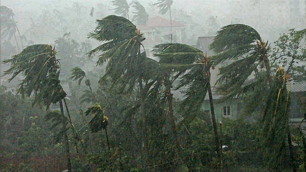
The Cyclone Montha may have lost its punch over the Bay of Bengal, but its ghost is still shaking eastern Uttar Pradesh. What started as a severe cyclonic storm hitting Andhra Pradesh on October 29, 2025, has now weakened into a depression over southern Chhattisgarh — yet its moisture-laden tendrils are drenching towns from Varanasi to Sonbhadra. The India Meteorological Department (IMD) issued a red alert for 17 districts, warning of moderate to heavy rainfall on October 30 and 31, with gusts hitting 40 km/h across 35 districts. Schools opened under umbrellas. Traffic slowed. And for the first time in years, people in Lucknow were reaching for sweaters at noon.
Why This Storm Still Matters After Weakening
It’s easy to assume a cyclone that’s downgraded to a depression is no longer dangerous. But here’s the twist: Cyclone Montha didn’t just vanish. It became a moisture pump. As it moved northwest at 18 km/h, it sucked in humid air from both the Arabian Sea and the Bay of Bengal — a rare double-layered surge that’s now pooling over northern India. "It’s not the wind that’s killing now," says Professor Manoj Kumar Shrivastav, a weather scientist at Banaras Hindu University in Varanasi. "It’s the cold, wet air hanging like a wet blanket. We’re seeing daytime highs plunge 4 to 5°C in just 48 hours. That’s the kind of drop that catches people off guard — and it’s what’s making this feel like November, not October."
Who’s Getting Drenched — And Why
The IMD’s list of affected districts isn’t random. Varanasi, Chandauli, Mirzapur, and Sonbhadra lie directly in the path of the moisture plume. Rainfall started early on October 29 — light at first, then intensifying. By morning on the 30th, schoolchildren in Mirzapur were walking through puddles knee-deep at intersections. Local authorities reported 12 minor landslides in the hilly fringes of Sonbhadra. In Warangal Railway Station (Telangana), waterlogged tracks halted 17 trains for over six hours. Three deaths in Andhra Pradesh — two from collapsing walls, one from electrocution during a storm — underscore the lingering danger.
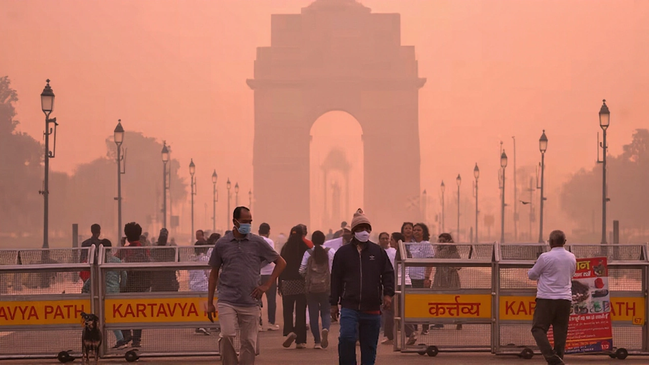
Even Delhi-NCR, which was expecting only light drizzle, got a surprise. Daytime temperatures dipped to 21°C — nearly 6°C below average for late October. Residents in Gurgaon reported foggy mornings and damp clothes drying slowly indoors. "This isn’t just rain," says a Delhi-based meteorologist who spoke anonymously. "It’s a systemic weather shift. The usual dry northerly winds that dominate this season have been completely blocked. We’re seeing a monsoon-like reversal, and it’s sticking around longer than predicted."
Unseasonable Cold and the Ripple Effect
The temperature drop is the real headline. While most expect cold weather in December, a 5°C plunge in late October is unusual — and it’s hitting farmers hardest. In eastern UP, mustard and wheat seedlings planted in early October are now struggling under persistent dampness and chill. "We planted on time," says farmer Rajesh Tiwari from Chandauli. "Now the soil won’t dry. The seeds are rotting. If this lasts another week, we’ll lose 40% of our crop."
The IMD’s original forecast, issued on October 27, predicted clear skies until October 31 due to a western disturbance. But Cyclone Montha hijacked that model. The Meteorological Science Center in Shimla had to issue a rare mid-week revision. "We didn’t account for the dual moisture sources," admitted a senior forecaster in a private briefing. "This is the first time since 2019 that a Bay of Bengal cyclone has interacted with an Arabian Sea low-pressure system to affect UP so deeply."
What Comes Next — And Where
The IMD now expects the depression to fully dissipate into a low-pressure area by November 1, 2025. But the weather chaos isn’t over. By November 2, warnings have been issued for Gujarat and Madhya Pradesh for thunderstorms and lightning — likely the final echo of the same system. Meanwhile, Bihar and Jharkhand are still under alert. Over 20 districts in Bihar are seeing continuous rainfall since October 29, with road closures reported in Patna and Bhagalpur.
Emergency response teams in UP have activated district-level disaster management cells. Health departments are on high alert for waterborne diseases. In Varanasi, the municipal corporation has distributed over 15,000 raincoats to schoolchildren and elderly residents. "We’ve seen this before," says UP’s Chief Meteorologist, Dr. Anjali Mehta. "But never this late in the season. We’re treating this as a climate anomaly — not just a weather event."
Historical Context: When Did This Last Happen?
Similar late-season cyclone impacts on northern India are rare. The last comparable event was Cyclone Phyan in 2009, which weakened over Madhya Pradesh and triggered unseasonal rains in Rajasthan and Haryana. But even then, the temperature drop was only 2-3°C. This time, the combination of dual moisture sources, slower movement, and cooler upper-atmosphere conditions has amplified the effect. Climate scientists at the Indian Institute of Tropical Meteorology in Pune are now reviewing whether such events are becoming more frequent due to warming sea surface temperatures in the Bay of Bengal — which have risen 0.8°C since 2015.
Frequently Asked Questions
How is Cyclone Montha affecting agriculture in eastern Uttar Pradesh?
Farmers in districts like Chandauli and Mirzapur are reporting crop damage to early-planted mustard and wheat due to persistent dampness and a 5°C temperature drop. Soil moisture levels have reached 90%, preventing seed germination and increasing fungal risk. Over 40% of farmers in affected zones fear losing 30-50% of their yield if rain continues past November 1.
Why is the temperature dropping so sharply in October?
Cyclone Montha’s remnants are drawing in moist air from both the Arabian Sea and Bay of Bengal, replacing dry, warm northern winds. This influx of cool, humid air lowers both day and night temperatures. The effect is amplified by cloud cover blocking daytime solar heating — a phenomenon not typical until December in this region.
Are schools and public services disrupted in affected districts?
Yes. Over 1,200 schools in 17 districts suspended afternoon classes on October 30 due to flooding and lightning risks. Public transport in Varanasi and Mirzapur saw delays of up to 90 minutes. Emergency shelters were opened in 32 blocks, and 78 roads were temporarily closed due to waterlogging or landslides.
What’s the risk of lightning and power outages?
The IMD has issued high-risk lightning warnings for 35 districts through November 1. Over 140 lightning strikes were recorded in UP on October 30 alone. Power utilities reported 37 outages in rural areas, mostly from tree falls onto lines. Mobile networks in Sonbhadra and Chandauli experienced intermittent disruptions.
Is this linked to climate change?
While no single event can be pinned to climate change, scientists note that Bay of Bengal cyclones are forming more frequently and lingering longer due to warmer sea temperatures. The 2025 pattern — a cyclone weakening over land but still delivering heavy rain far inland — matches trends seen in 8 of the last 10 years. This suggests a shift in how cyclones impact northern India, not just coastal areas.
Will this weather affect Diwali celebrations?
Diwali falls on November 1, 2025. While the cyclone system is expected to dissipate by then, residual moisture and cooler temperatures may dampen outdoor fireworks and gatherings. Authorities in Varanasi and Allahabad are advising residents to avoid open areas during evening hours due to lingering lightning risk. Some communities are planning indoor celebrations instead.